Find the Assessment That Fits Your Needs
Get started now and have your assessment delivered within 24 hours.
EP Advance
Get all the intelligence you can--early and effectively--for your protection detail.
Our EP Advance is comprehensive, fast, and cost effective.
Quickly and effectively come up to speed on your destination and protection environment.
Who is this for?
- Executive protection managers conducting initial scoping for an upcoming visit who need a rapid, reliable overview of the local environment, neighborhood conditions, transit routes, and potential friction points before committing resources or shaping the itinerary.
- EP detail leaders preparing for a trip on short notice who require fast-turnaround intelligence on hotels, venues, arrival points, travel corridors, chokepoints, and any emerging issues that could affect the movement or safety of the principal.
- Protection teams coordinating multi-stop itineraries and needing a unified picture of conditions across several destinations—airport arrival environment, hotel area, meeting sites, event venues—to understand how risks and constraints compound across the full route.
- Corporate security units supporting traveling executives who want concise, standardized assessments that can be integrated into briefs, movement plans, and contingency procedures without additional interpretation.
- Firms handling visiting dignitaries, VIPs, or high-net-worth principals who require a third-party snapshot of ground reality to validate assumptions, identify hidden issues, and support the development of advance plans, route selection, and protective posture.
Working on your own report? Let us help.
If you are working on your own work product, we can get you 80-90% of the way there, while informing the remaining portions. Integrate our results into your own report with or without attribution. We can deliver assessment results via a docx file for easy extraction and adoption.
It's easier, faster, and cheaper than doing it yourself!
Assessment Sections
The following report sections are included in each EP Advance report.
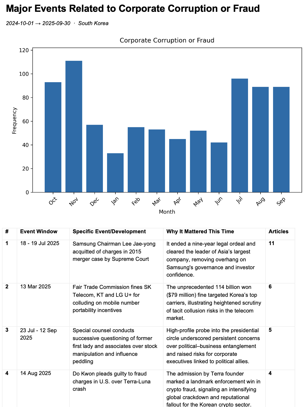
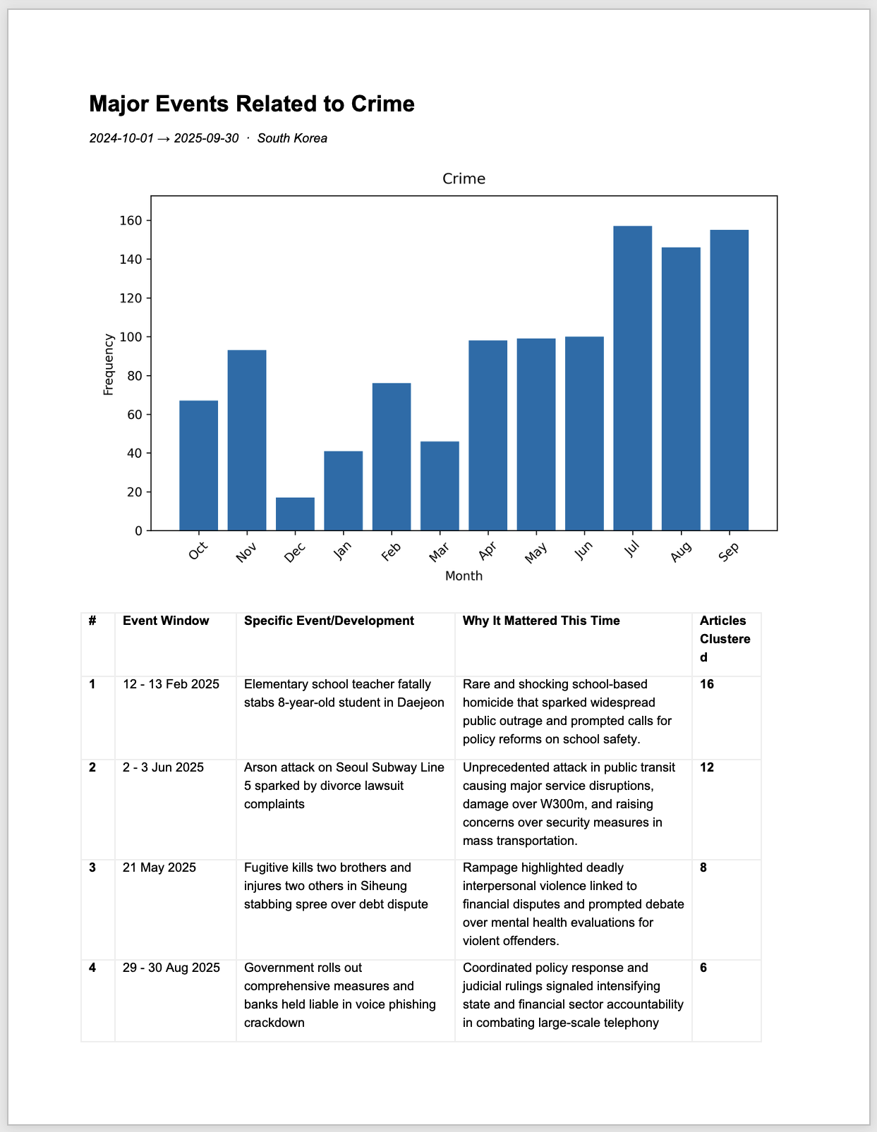
Risk Events
What risk events actually occurred over the last 12 months? We outline all the major ones across 26 risk categories.
- Accidents
- Climate Change
- Communal and Religious Strife
- Corporate Corruption or Fraud
- Crime
- Critical Infrastructure Failure
- Cyber Attacks and Data Loss
- Epidemics and Pandemics
- Extreme Weather Events
- Geopolitical Conflict and Disputes
- IP Protection
- Man-made Environmental Disasters
- Natural Disasters
- North Korea
- Political Scandal or Corruption
- Pollution
- Privacy
- Product Recalls
- Protest, Demonstration, Dissent
- Regulation
- Regulatory Enforcement Actions
- Shifting Geopolitical Alliances
- South China Sea
- Strikes and Work Stoppages
- Supply Chain Issues
- Terrorism
~40-50 pages in length
How This Section is Made
Risk Events
Prominent risk events are discerned and reported on for each category of risk we cover. The events are derived from previous “Developments” we have reported on for our intelligence reports over the last 12 months. Developments represent what people on the ground, in country, are talking about, writing about, and creating policy for.
Since our intelligence reports come out three times per week, we are often reporting on continuing stories and issues each week as they develop and morph. For our assessments, we then pull from these previously identified events to find the ones that represented the largest sources of risk over time rather than just the short snapshot given in acute reports.
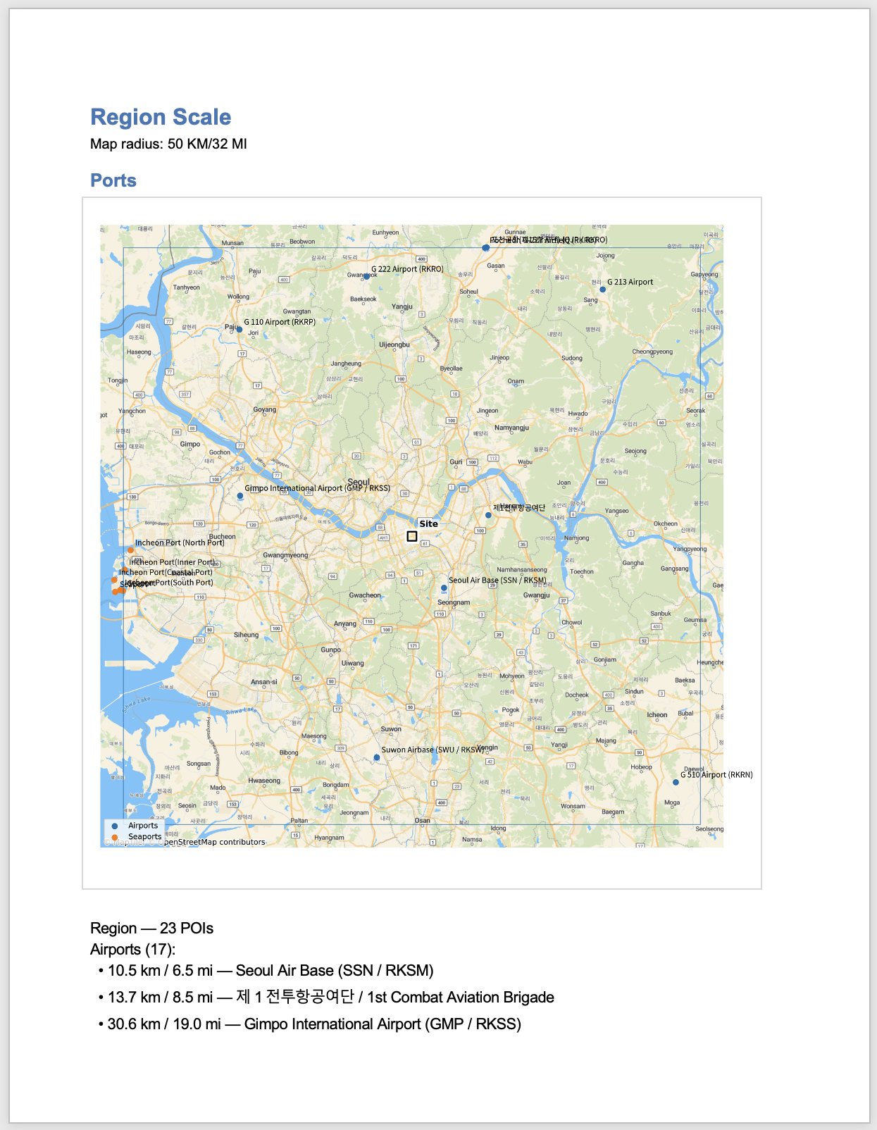
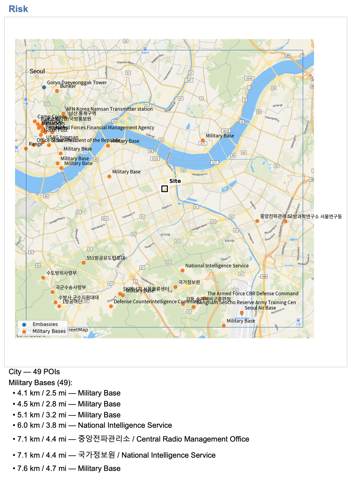
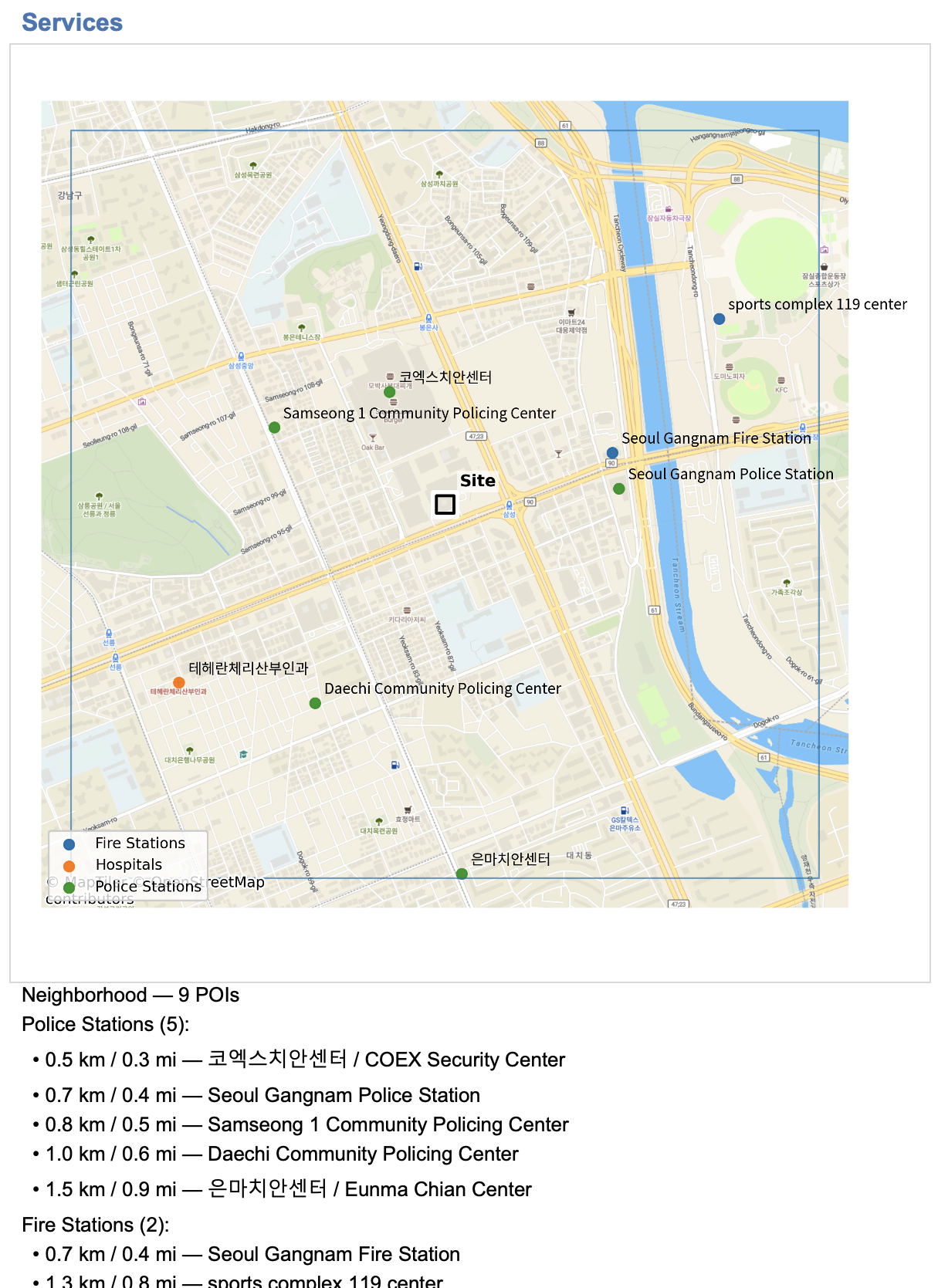
Region, City, Neighborhood
An analysis of three different geographic scales, with the primary site of interest at the center of each scale map.
These maps are not meant for navigation, but rather to provide context about the risk environment of the area surrounding the primary address at three different scales.
Different kinds of Points of Interest (POIs) are shown on each map, with the understanding that different kinds of sites offer opportunity and may attract attention and risk.
These maps may be useful for understanding the concentration of critical infrastructure, services, and transportation "heat" in the area, as well as that of potential vulnerabilities and risks.
~40 pages in length
How This Section is Made
We gather data on the key sites at each scale then plot them on maps of that scale, along with listing the distance of each site to the primary address of concern.
At each scale, we look at the following types of sites:
Ports: Airports, Seaports
Transit: Subways, Trains
Infrastructure: Power Plants, Water Plants
Services: Police, Fire, Hospitals
Risk: Military Bases, Embassies
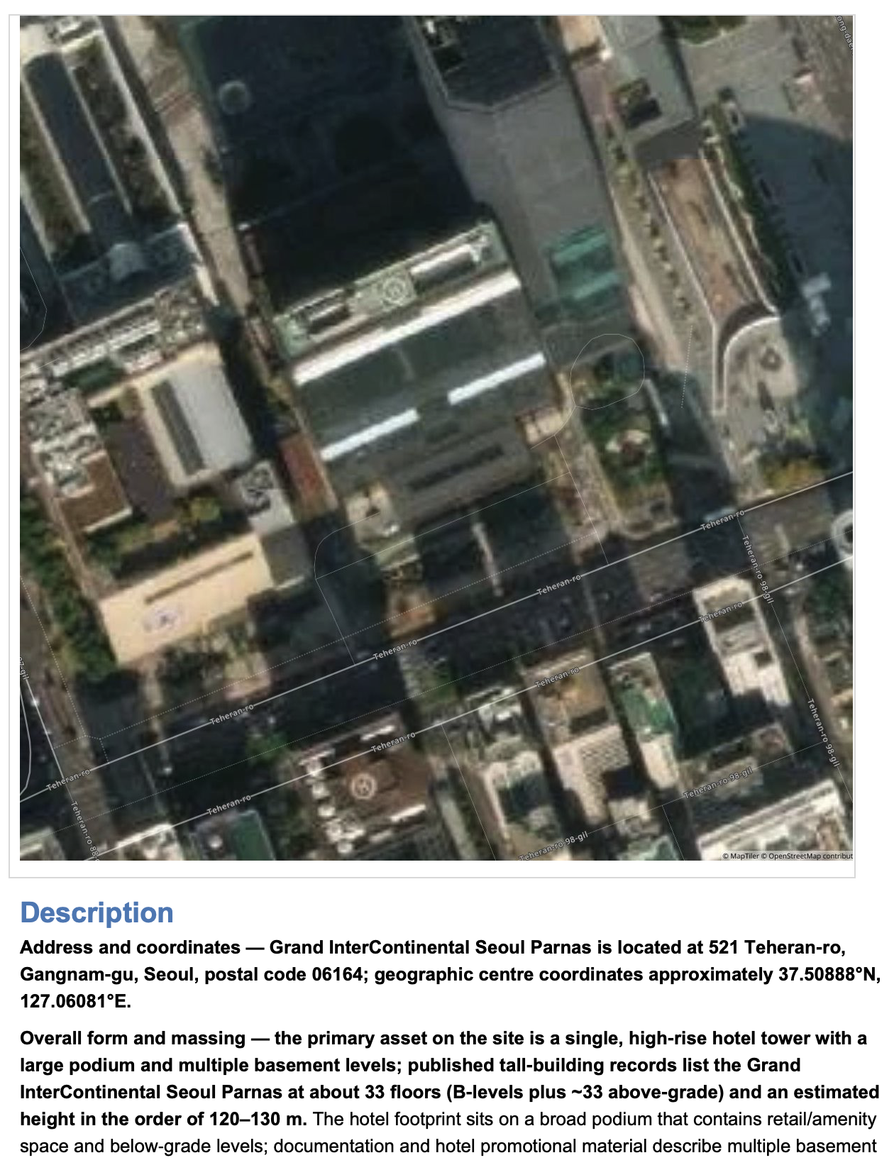
Site Analysis
This section looks directly at the specific site you are interested in.
We provide an analysis of the site, assets on the ground, and the immediate area around the site.
We conclude with a description of the site and an analysis of site-specific risk based on past events at the site, in the area, and nationally.
~6 pages in length
How This Section is Made
Images and maps of the site are combined with:
Site Description: An in-depth description of the site and its surroundings.
Site-Related Risk Based on Past Events: An analysis of site-related risk based on events that have happened on or near the site in the past. This includes the neighborhood and regular/expected flows around the site.

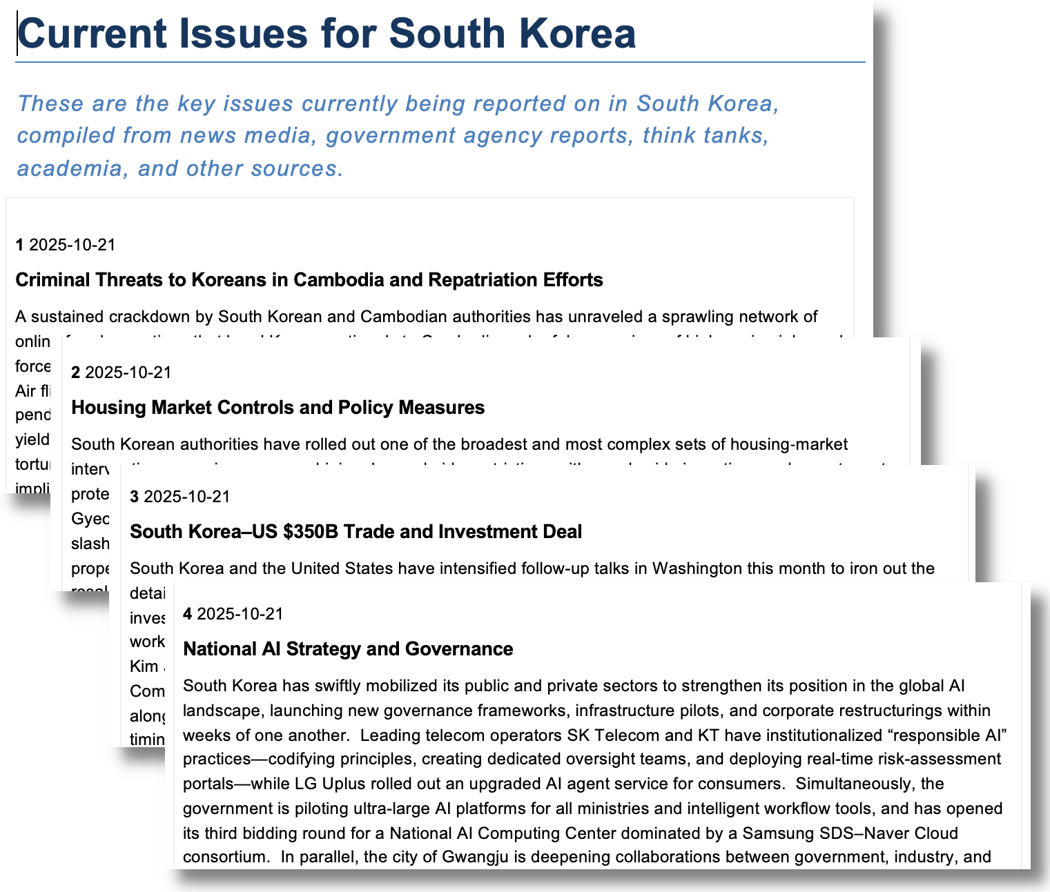
Current Issues
What's happening right now? What is everyone on the ground talking about, writing about, and concerned about right now?
Current Issues are derived from the "Developments" of the past two weeks--what was reported on in our country intelligence Daily Briefings over that period. We select only those developments spanning the whole of the last week (or longer) for inclusion.
~5-8 pages in length
How This Section is Made
Data is gathered from our intelligence data and from recent Developments reporting we have done. From among those Developments, we look for the most impactful ones that are currently still ongoing.
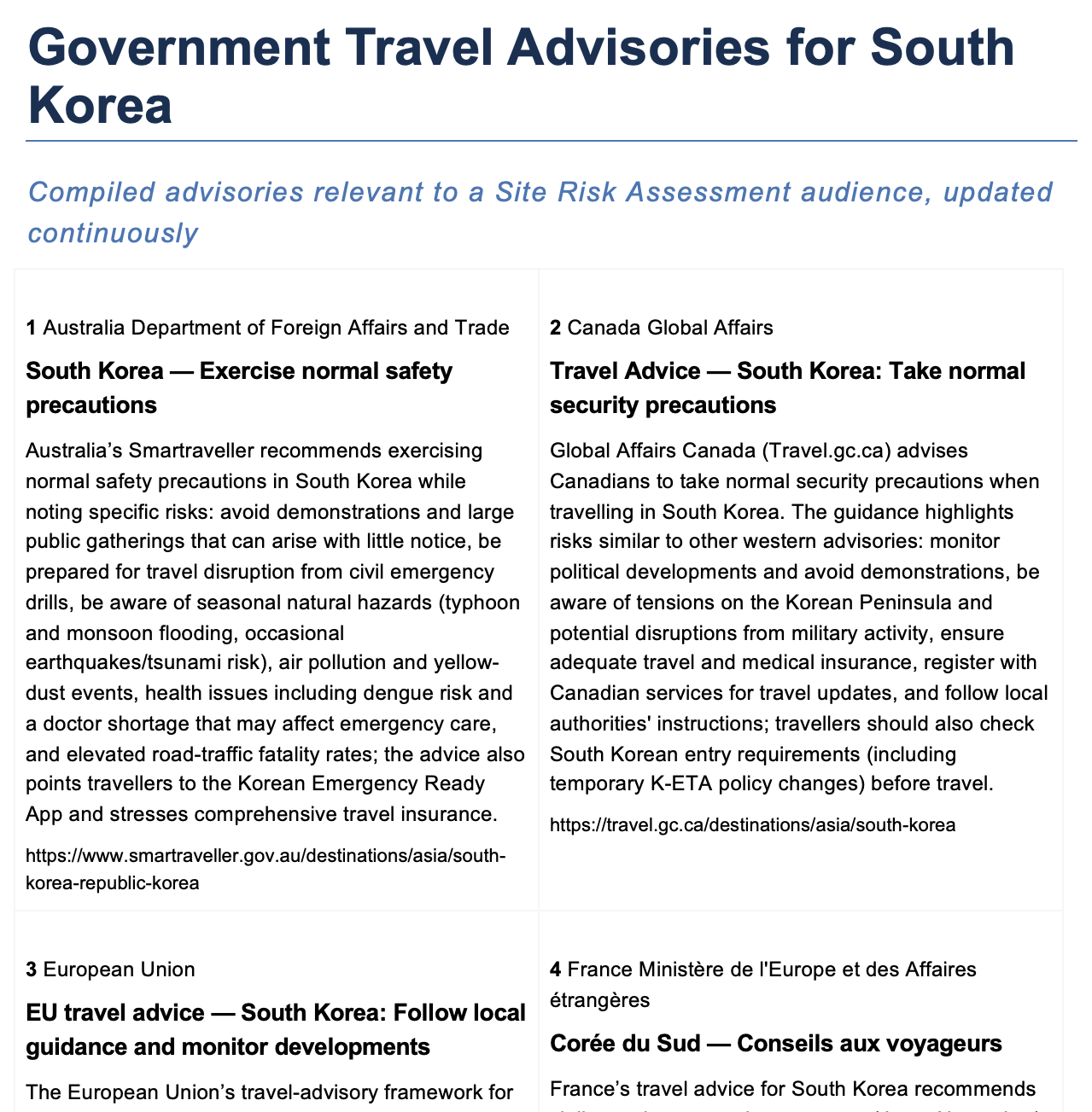
Government Advisories
A survey of a variety of government travel advice for your destination.
Government agencies currently surveyed include:
- US Department of State
- UK Foreign, Commonwealth & Development Office
- Canada Global Affairs
- Australia Department of Foreign Affairs and Trade
- New Zealand Ministry of Foreign Affairs and Trade
- European Union
- Germany Auswärtiges Amt
- France Ministère de l'Europe et des Affaires étrangères
- Japan Ministry of Foreign Affairs
- Singapore Ministry of Foreign Affairs
~3 pages in length
How This Section is Made
Advisory data from all 10 named agencies is scraped directly from the open website data of the agencies. This is done during report creation so that the data is as fresh as possible.
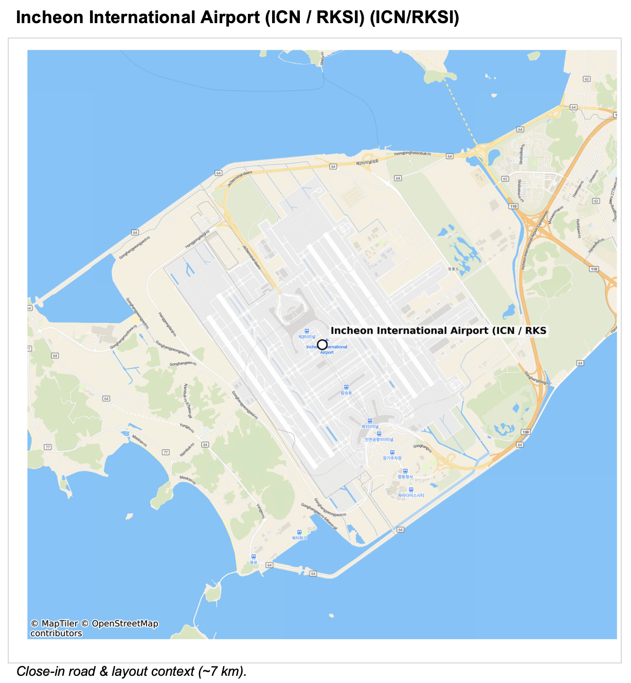
Airport Advance
An advance examination of the potential airports serving the main city of destination.
Map of Main International Airports serving the City
Here we look at the potential airports for arrival and departure, as well as crisis management.
Analysis of Each Airport
We analyze each airport for:
- Threat snapshot (GMP-specific)
- Key contacts
- Terminals, movement & meet points
- Ground side: vehicles & routes
- VIP / Meet‑Assist (MAAS)
- Ops & OPSEC
- Health & special cases
- Contingencies
Airport Travel Environment
We look at the "travel demand" or "passenger density" of each candidate airport at the time of your arrival. How does that demand compare with average demand over the last 21 days? In essence, how crowded will the airport be? Very crowded indicates potential delays and high passenger density. Unexpectedly low demand could signal acute problems with the airport's infrastructure.
~7-10 pages in length
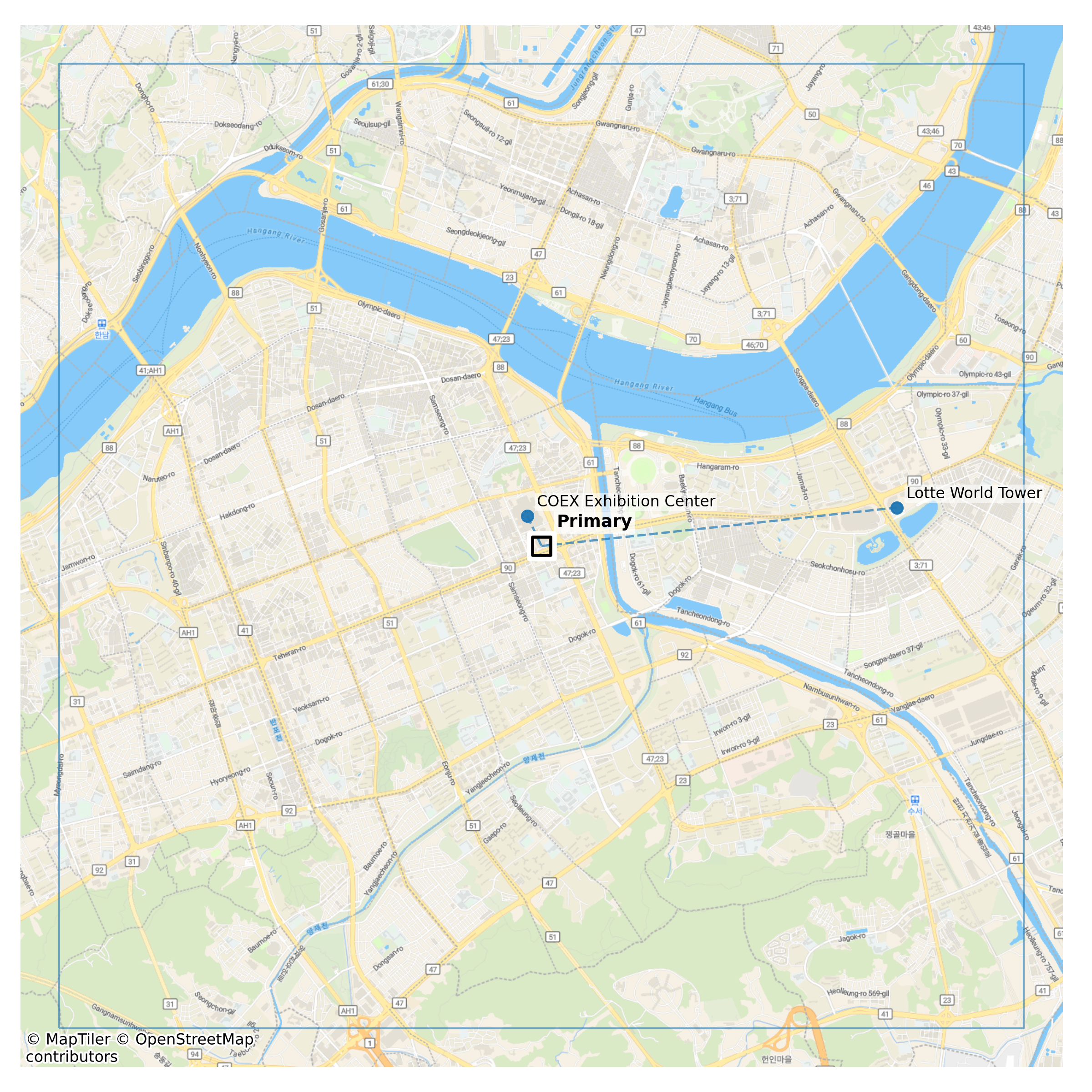
City Advance
Map out your visit, with a rendering of each location relative to each other--one primary address and up to four additional addresses.
Learn distances, directions, expected travel times, and the nature of the areas you'll be passing through.
~3-10 pages in length
Have questions about our assessments?
How can we help?

Ready to order your EP Advance Assessment?
Get started now and have your assessment delivered within 24 hours.
See EP Advance Pricing and OptionsAssessments FAQ
Each section of every report is generated independently using its own data pipelines and analytic methods. For a detailed explanation of how data is gathered, processed, and correlated for each assessment type, please refer to the individual product pages.
For site-focused reports, the analysis is tailored to the exact address or site you specify. For national-level reports, the primary variable is the date on which the assessment is produced, as all analysis reflects the most current one-year window of available data.
While each assessment follows a standardized production methodology for consistency, all underlying data is freshly collected and bounded to the previous 12 months to ensure relevance, trend visibility, and accuracy.
If you require an assessment for a location outside our current coverage, please contact us. We will review your request and advise whether we can produce it.
As a result, the information incorporated into our assessments is refreshed continuously and is as current as feasibly possible.
For online transactions, Erudite Intelligence does not collect or store any payment information; all payments are processed securely through PayPal. For invoiced corporate clients, only the billing details required for invoicing are collected.
We are also available for additional bespoke analysis or tasking upon request.
For site-focused assessments, we need the primary site address or exact site name.
For Executive Protection (EP) Advance reports covering multiple sites (up to five), we require the primary location plus any secondary addresses.
Because precise geolocation is critical to accurate analysis, we may contact you for clarification if any address information appears incomplete or ambiguous.
Each question is optional, but the more information you provide, the better we can tailor the assessment to your unique situation. Answer as many or as few questions as you are comfortable with.
Explore Our Assessments
Find the Assessment That Fits Your Needs